|
ANZA-BORREGO SOUTH : ROADS
Carrizo Badlands
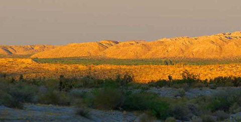
Carrizo Badlands in Late Afternoon Light
The area called the Carrizo Badlands consists not only of badlands where
little or nothing grows, but also of dry creeks and washes, canyons, and
a few flat hard-soiled mesas.
You have a couple of choices. One is to climb into your 4-wheel drive vehicle
and bounce down the road, and hope you have a nice day and find your way
back. The other is look closely at the terrain and try to figure out what
has happened here over the past several million years and how.
The area the maps call the Carrizo Badlands is a vast mixing bowl. Some
of the soil is original or native, some of it washed in with the Colorado
River, and some washed up from the Gulf of California. The river brought
wood, now petrified. Ancient lakes and rivers supported plant life and the
plant life supported birds and animals whose bones and in some cases hoof
prints can still be seen. And then, just to mix things up a little more,
the area has experienced volcanic activity, earthquakes (which of course
still happen), and incredible landslides which would be on the nightly news
and the front pages of all the papers if they had happened today.
After exploring this area and examining its geological and paleontological
history, a person can walk or drive down a road and tell from where one
piece of soil originated or what kinds of fossil material it may hold. For
some people, that's a pretty good thing to be able to do.
|