|
|
ANZA-BORREGO NORTH |
|
The northern part of Anza-Borrego extends from north of
Borrego Springs up
Coyote Canyon to Anza in Riverside County, then east and southeast across
the Santa Rosa Mountains almost to Highway 86 and the Salton Sea.
Compared to the lower end of the Salton Sea, which is 200 feet below sea
level, this is high country where trailheads start at under 1,000 feet above
sea level. |
 |
As you move toward the mountains to the west and north, you move from the desert
to life zones as higher elevations, including pinyon-juniper woodland and
chaparral
Anza-Borrego North offers abundant opportunities for driving and hiking. You may
focus on such subjects as native Americans, botany, wildlife, geology (including
paleontology), or history.
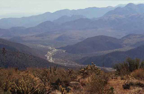
Photo: Coyote Canyon from Table Mountain on the north edge of
Anza-Borrego Desert State Park.
The
Sculpture of Ricardo Breceda
|
|

|
|

|